Uijeongbu (Uijeongbu-si)
Uijeongbu is a city in Gyeonggi Province, South Korea.
Uijeongbu is located north of the Korean capital Seoul; it lies inside a defile, with mountains on two sides, and commands a natural choke point across the main traditional invasion route from the North into Seoul. As such it has a continued military significance and it contains U.S. and Korean military bases, positioned for the defense of the Korean capital. The U.S. Second Infantry Division has established a headquarters post in Uijeongbu, with the main troops being deployed from Dongducheon city. US Military bases in Uijeongbu have since closed.
Despite being known for its military presence, the area has boomed into a satellite community of Seoul with shops, cinemas, restaurants and bars, PC bangs and DVD Bangs. In addition to U.S. personnel, it is popular with the English hagwon (a for-profit private institute, academy or cram school). There are several mountains such as Mt. Dobong (Dobongsan), Mt. Surak and Mt. Soyo. The mountains are popular recreational areas for hiking and are frequented by residents living in the Seoul Metropolitan area.
This city is also famous for its budae-jjigae (lit. "army base stew"), made with hot dogs and SPAM. In the late 20th century, many wanted the dish to be referred as Uijeongbu jjigae to remove the military or war-time connotations it had associated with it. However, not many restaurants followed this guideline. Some restaurants have begun calling their product Uijeongbu budae jjigae. The city also contains what locals refer to as "buddaejjigae street", a street where there is a high concentration of army base stew restaurants.
Map - Uijeongbu (Uijeongbu-si)
Map
Country - South_Korea
 |
 |
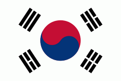
| Flag of South Korea | |
The Korean Peninsula was inhabited as early as the Lower Paleolithic period. Its first kingdom was noted in Chinese records in the early 7th century BCE. Following the unification of the Three Kingdoms of Korea into Silla and Balhae in the late 7th century, Korea was ruled by the Goryeo dynasty (918–1392) and the Joseon dynasty (1392–1897). The succeeding Korean Empire (1897–1910) was annexed in 1910 into the Empire of Japan. Japanese rule ended following Japan's surrender in World War II, after which Korea was divided into two zones; a northern zone occupied by the Soviet Union and a southern zone occupied by the United States. After negotiations on reunification failed, the southern zone became the Republic of Korea in August 1948 while the northern zone became the communist Democratic People's Republic of Korea the following month.
Currency / Language
| ISO | Currency | Symbol | Significant figures |
|---|---|---|---|
| KRW | South Korean won | â‚© | 0 |
| ISO | Language |
|---|---|
| EN | English language |
| KO | Korean language |


